
Aoraki / Mount Cook National Park: glaciers, peaks and dark skies
Published on 08/25/2026 at 21:42 | Editorial responsibility: Rafael Müller, Editor-in-Chief AD HOC NEWS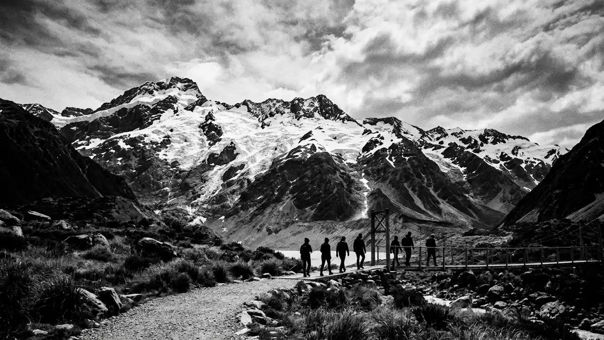
Aoraki / Mount Cook National Park is New Zealand’s high alpine heart, rising above Mount Cook Village on the central-west of the South Island. In this landscape, the country’s highest mountain, Aoraki / Mount Cook, anchors a park of glaciers, jagged ridges and deep valleys that has been protected since 1953.
Glacier country beneath New Zealand’s highest peak
The park takes its name from Aoraki / Mount Cook, the highest summit in New Zealand and the central peak of the Southern Alps. The mountain reaches 3,754 m (12,316 ft), forming a snow-clad pyramid surrounded by a ring of other high summits.the highest point in New ZealandThese peaks sit along the main divide of the Southern Alps, where the park extends for around 65 km (40 miles) along the crest and meets Westland Tai Poutini National Park on the western side.extends for about 40 miles
Aoraki / Mount Cook National Park is dominated by ice. Glaciers cover roughly 40% of its area, flowing down from the high basins into valleys cut into greywacke and schist rock.glaciers which cover 40 percentWithin the park, there are many named glaciers, including the long Tasman Glacier and the Hooker Glacier on the flanks of Aoraki. Ice, rock and snow create a terrain where ridges rise sharply, and the valley floors carry moraine, braided rivers and glacial lakes with pale, milky water.
An alpine park with protected status
The national park was established in October 1953, part of a mid twentieth-century move to safeguard the Southern Alps as a protected landscape.established in October 1953It covers around 707 km² (273 square miles), occupying the eastern flank of the range and lying within the Canterbury Region.an area of 273 square milesThe park boundary follows the alpine crest for several dozen kilometres, sharing a long border with Westland Tai Poutini National Park and forming part of a continuous band of protected land across the South Island.
Since 1990, Aoraki / Mount Cook National Park has been one of the core components of Te W?hipounamu – South West New Zealand, a UNESCO World Heritage site recognised for its glaciers, fjords, and intact temperate rainforest.part of the Te WahipounamuThe park also lies within the Aoraki Mackenzie International Dark Sky Reserve, which protects low levels of artificial light and makes the area an established destination for stargazing and astronomical observation.Aoraki/Mackenzie International Dark Sky Reserve
Mount Cook Village and the experience of altitude
Mount Cook Village sits near the head of the Hooker and Tasman valleys, beneath the eastern faces of the main peaks. It functions as the gateway settlement for the park, with lodges, smaller accommodation and services concentrated in a pocket of relatively gentle terrain. From the village, roads lead to car parks at the foot of the main valleys, where walking tracks begin and views open towards the glaciers, lakes and surrounding summits.
The altitude in the park rises quickly from valley floor to summit. Many peaks climb above 3,000 m (9,843 ft), and the highest ridges carry permanent snow and ice throughout the year.27 peaks rising above 10,000 feetThis relief creates steep slopes and narrow ledges, with rock faces cut by couloirs and gullies. On the valley floors, tracks follow river flats and moraines, crossing swing bridges and sections of boardwalk where wetlands and streams require raised routes.
Visiting Aoraki / Mount Cook National Park: what travellers from Western Europe should know
- Aoraki / Mount Cook National Park lies in the central-west part of New Zealand’s South Island, with Mount Cook Village as the main settlement. The park is reached by road, which connects the village with other centres in the Canterbury and Otago regions.
- The terrain is alpine, and many tracks include sections of uneven ground, stone steps and exposed valley slopes. Approaches to viewpoints and glacier lakes typically involve walking on gravel paths and formed tracks rather than paved surfaces.
- Within the park, access routes lead into valleys shaped by glaciers, and some paths cross swing bridges over fast-flowing rivers. Visitors who continue beyond formed tracks into high alpine areas enter steep, glaciated terrain where mountaineering skills and appropriate equipment are required.
- The official language is English and the currency is the New Zealand dollar.
- Entry requirements depend on your nationality; UK travellers can check the FCDO travel advice at gov.uk/foreign-travel-advice, Irish travellers the Department of Foreign Affairs at ireland.ie.
Searching for Aoraki / Mount Cook National Park on social platforms
These links open searches for Aoraki / Mount Cook National Park on each platform.
Frequently asked questions about Aoraki / Mount Cook National Park
Where is Aoraki / Mount Cook National Park located?
Aoraki / Mount Cook National Park is on the central-west of New Zealand’s South Island, in the Canterbury Region, with Mount Cook Village as its main gateway.
What can visitors expect on a visit to the park?
Visitors encounter an alpine landscape of glaciers, high peaks, glacial lakes and river valleys, with formed tracks leading from Mount Cook Village into the surrounding terrain.
What makes Aoraki / Mount Cook National Park distinctive?
The park combines New Zealand’s highest mountain, extensive glaciation and recognised dark skies within a UNESCO-listed World Heritage area, giving it an unusual concentration of protected natural features.


