
Angkor Thom, the walled Khmer capital at Angkor
Published on 09/15/2026 at 16:10 | Editorial responsibility: Rafael Müller, Editor-in-Chief AD HOC NEWS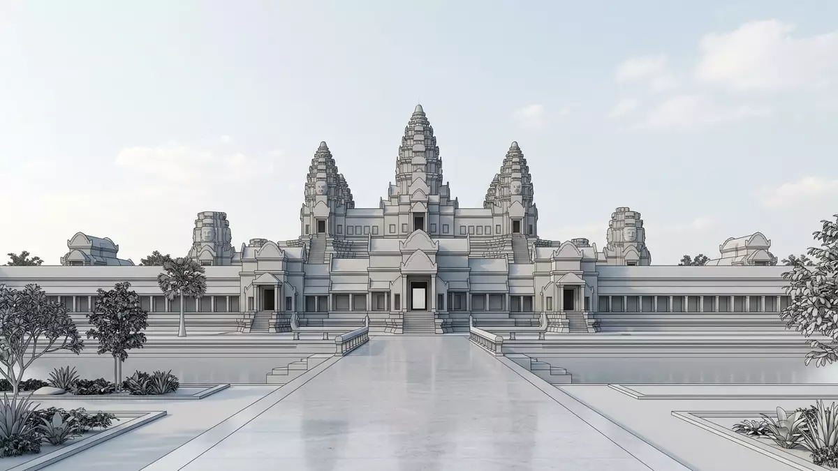
Angkor Thom near Siem Reap in Cambodia is a former royal city enclosed by walls and a moat, laid out as a vast square and filled with monumental stone temples. It formed the last and most enduring capital of the Khmer Empire in the late twelfth century, anchored by Bayon at its centre and royal terraces along a broad ceremonial square.
The “Great City” of Jayavarman VII
The name Angkor Thom means “Great City” in Khmer and refers to a planned royal capital rather than a single temple. The city was established as the main seat of power under King Jayavarman VII in the late twelfth century, during a period when the Khmer Empire controlled much of mainland Southeast Asia.late twelfth century capital Its surviving monuments lie within Angkor Archaeological Park, north of Angkor Wat and on the western side of the Siem Reap River, which drains towards the Tonle Sap lake.west bank of the Siem Reap River
The city is laid out on a square plan of about 9 km², enclosed by laterite and stone ramparts and a moat, with five monumental gates set into the walls.area of some 9 km² Causeways approach these gateways across the moat, lined with sculpted figures grasping naga serpents, leading into straight processional roads that converge on Bayon at the geometric centre of the city.grid-plan of roads
Bayon and the sacred centre of Angkor Thom
Bayon stands at the exact geometric centre of Angkor Thom and served as the state temple of the capital. It is built in what is now known as Bayon style, with its mass of towers carrying enormous carved faces looking out in multiple directions.Bayon at the city’s geometric centre The temple rises over three main levels linked by stairways and small courtyards, wrapping visitors in galleries of bas-reliefs that depict battles, religious processions and everyday scenes of the Khmer world.three levels linked by stairs
North of Bayon a large open space marks the former central square of Angkor Thom, framed by royal structures such as Baphuon, Phimeanakas and the remains of palace buildings. Baphuon, slightly to the west of Bayon, is a steep, tiered temple mountain, while Phimeanakas occupies the palace enclosure nearby as a smaller pyramid composed of sandstone blocks.Baphuon slightly to the west This concentration of sanctuaries and platforms at the centre of the walled city shows how closely the religious and political spheres were intertwined in Jayavarman VII’s capital.
Royal terraces and processional spaces
Along the western edge of the central square runs the Terrace of the Elephants, a long raised platform clad in reliefs of elephants, lions and mythical guardians. The terrace forms the eastern boundary of the royal enclosure and extends for about 300 m, with staircases leading down towards the space that once held crowds and ceremonies.300-metre-long elevated stone terrace Its carved panels show war elephants, garudas and other figures, making the structure one of the most elaborate surviving examples of Khmer decorative stonework on a civic monument.terrace forms the east wall of the Royal enclosure
To the north stands the Terrace of the Leper King, another stone platform with deeply carved reliefs along an inner passage, connected at its southern end to the line of the Terrace of the Elephants. Together these terraces form a continuous sequence of raised viewing and ceremonial spaces along the edge of the central square, facing towards areas that once held audience halls and performance grounds.Terrace of the Leper King Walking their length gives a clear sense of the horizontal scale of Angkor Thom’s public architecture, in contrast to the vertical rise of the nearby temple mountains.
Visiting Angkor Thom: what travellers from Western Europe should know
- Angkor Thom lies within Angkor Archaeological Park north of Angkor Wat, west of the Siem Reap River and several kilometres from central Siem Reap, reached along park roads used by vehicles and bicycles.
- Inside the walled city, main monuments such as Bayon, Baphuon and the royal terraces are linked by straight laterite roads and stone causeways; visiting them involves climbing steep stairways and walking across uneven stone surfaces.
- The surrounding province is Siem Reap in Cambodia, where the official language is Khmer and the currency is the Cambodian riel.
- Entry requirements depend on your nationality; UK travellers can check the FCDO travel advice at gov.uk/foreign-travel-advice, Irish travellers the Department of Foreign Affairs at ireland.ie.
Searching for Angkor Thom on social platforms
These links open searches for Angkor Thom on each platform.Frequently asked questions about Angkor Thom
Where is Angkor Thom in relation to Siem Reap and Angkor Wat?
Angkor Thom lies within Angkor Archaeological Park in Siem Reap Province, several kilometres north of Angkor Wat and north of central Siem Reap.
What should visitors expect when exploring Angkor Thom?
Visitors encounter a broad walled city with monumental gates, straight processional roads, temple mountains such as Bayon and extensive stone terraces, reached by walking and climbing stairways.
What makes Angkor Thom distinctive among Angkor’s sites?
Angkor Thom combines a planned square urban layout, a central face-tower temple in Bayon and long royal terraces, making it the clearest surviving example of a Khmer royal capital in stone.


