
Ala Archa National Park: Bishkek’s high mountain gateway
Published on 09/12/2026 at 21:15 | Editorial responsibility: Rafael Müller, Editor-in-Chief AD HOC NEWS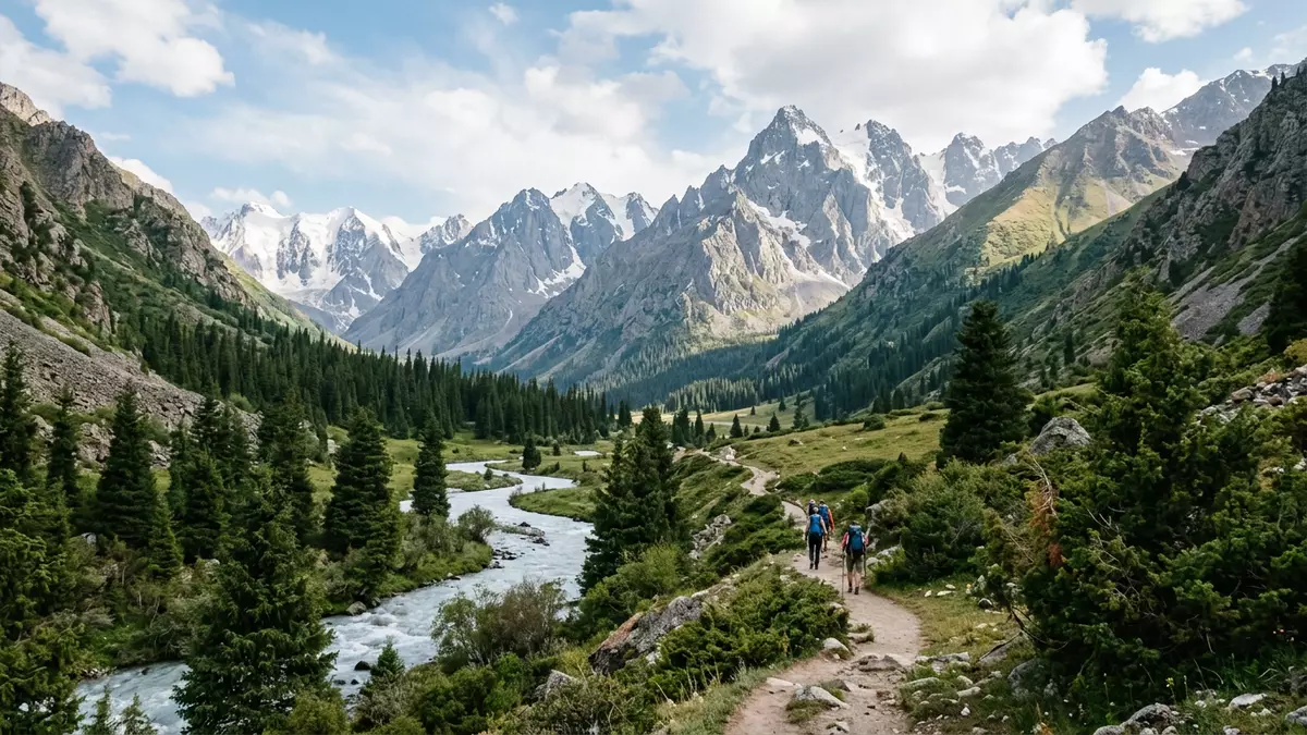
Ala Archa National Park is an alpine protected area in Kyrgyzstan’s Tian Shan mountains, rising south of Bischkek from a river gorge into high, glaciated peaks. Established in 1976 as a Kyrgyz state national park, it has become a recognised gateway to the Kyrgyz Ala-Too range for walkers, climbers and naturalists exploring the mountains above the Chuy region.
From city edge to high mountain terrain
The park lies in the Ala-Archa Gorge on the northern slopes of the Kyrgyz Ala-Too, a range forming part of the wider Tian Shan mountain system south of Bischkek.Tian Shan mountains The protected area follows the basin of the Ala-Archa River and its tributaries, where meltwater from permanent snowfields and glaciers gathers into streams that cut down towards the plains.gorges of the Ala-Archa River
From the entrance area the terrain rises from around 1,500 m (4,921 ft) above sea level into a belt of mid-mountain slopes and further into high alpine ground, where summits in the Kyrgyz Ala-Too reach close to 4,895 m (16,060 ft).altitude from 1,500 m to 4,895 m This sharp elevation gain within a relatively compact area gives Ala Archa National Park a layered structure: forested lower slopes, open alpine meadows and bare rock ridges under glaciated peaks.
A protected alpine landscape since 1976
Ala Archa National Park was formally created in 1976 to safeguard high mountain landscapes and alpine ecosystems in the Kyrgyz Ala-Too and the Ala-Archa River basin.established in 1976 As a state national park, its territory extends over roughly 194 km² (19,400 ha), encompassing river gorges, steep slopes and a concentration of high summits in the Chuy region.194-km² high mountain national park
The park includes dozens of separate peaks and a notable set of glaciers, with glaciated surfaces covering a documented share of the total area. Measurements published for Ala Archa National Park indicate that these glaciers together occupy around 33 km², a significant portion of the landscape, and that the glaciated zone has contracted since the mid twentieth century.33 km² of glaciers Against this backdrop, the park’s status as a specially protected natural area emphasises conservation of ice, rock, forest and mountain pastures alongside recreational use.
River, forests and routes into the heights
The Ala-Archa River runs the length of the valley, gathering meltwater from the surrounding ridges into a single course that continues out towards the plains north of the mountains.Ala-Archa River Spruce and juniper forest covers extensive sections of the lower and mid slopes, giving way higher up to alpine meadows and rock. Within the park boundary the ridges are capped by permanent ice and snow, and the combination of forested lower ground and glaciated summits is one of the park’s defining visual contrasts.
Ala Archa National Park is reached by road from Bischkek, with the entrance standing south of the city in the Chuy region.40 km from Bishkek town Inside the park, vehicle access runs to a developed area in the lower valley, from which marked paths continue on foot towards viewpoints, waterfalls, mountain huts and glacier approaches. From this starting point, routes fan out along the river and up side valleys, forming the basis for day walks from the city and for more strenuous ascents deeper into the Kyrgyz Ala-Too.
Visiting Ala Archa National Park: what travellers from Western Europe should know
- Ala Archa National Park lies south of Bischkek in Kyrgyzstan’s Chuy region, reached by road along the Ala-Archa Gorge into the Kyrgyz Ala-Too range.
- The terrain rises quickly from river level into steep forested slopes, then alpine meadows and rocky ridges, and many walking routes involve sustained gradients and uneven mountain paths.
- The park’s mountains form part of the high Kyrgyz Ala-Too range, and excursions towards glaciers or high passes lead into terrain where weather and visibility can change rapidly.
- Nearby, the river valley opens towards Bischkek and the wider Chuy plain, so Ala Archa National Park is often combined with time in the city and other sites in northern Kyrgyzstan.
- The official language is Kyrgyz and the currency is the Kyrgyzstani som. Entry requirements depend on your nationality; UK travellers can check the FCDO travel advice at gov.uk/foreign-travel-advice, Irish travellers the Department of Foreign Affairs at ireland.ie.
Searching for Ala Archa National Park on social platforms
These links open searches for Ala Archa National Park on each platform.
Frequently asked questions about Ala Archa National Park
Where is Ala Archa National Park?
Ala Archa National Park is in northern Kyrgyzstan, in the Chuy region south of Bischkek, in the Ala-Archa Gorge on the northern slopes of the Kyrgyz Ala-Too range.
What should visitors expect on a visit?
Visitors encounter a high mountain landscape with forested river valleys, steep paths, alpine meadows and views towards glaciated summits, with routes ranging from short walks to demanding ascents.
What makes Ala Archa National Park distinctive?
The park’s distinction lies in the combination of accessibility from Bischkek and a compact concentration of high peaks, glaciers, forest and river gorges within a single protected alpine area.


