
Aitutaki Lagoon and the turquoise triangle of the South Pacific
Published on 08/29/2026 at 08:32 | Editorial responsibility: Rafael Müller, Editor-in-Chief AD HOC NEWS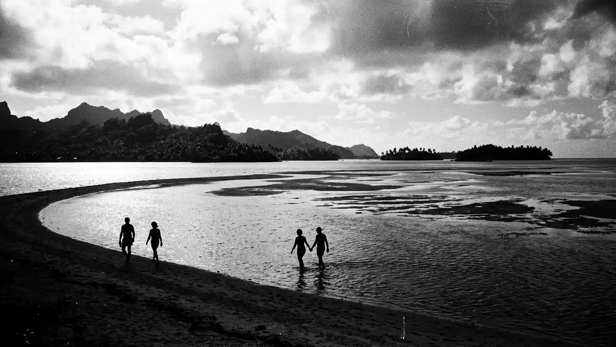
Aitutaki Lagoon spreads around the island of Aitutaki in the southern Cook Islands, a shallow triangle of turquoise water, coral reef and low sand islets. The lagoon forms the defining landscape of this almost-atoll, encircling the main volcanic island with clear water and pale sand banks.
A triangular lagoon around a volcanic core
Aitutaki lies in the South Pacific as part of the southern group of the Cook Islands, north of Rarotonga, and is classed by geologists as an almost-atoll.Aitutaki Atoll The atoll combines a central high island of volcanic rock with a surrounding coral reef that encloses the lagoon on three sides in a broad triangular arc.a lagoon of 74 km² The land area of Aitutaki is a little over 18 km² (about 7 sq mi), with the main island carrying most of that ground.total land area is 18.05 km²
The volcanic core rises towards Maungapu, the highest point on Aitutaki at about 124 m (407 ft) above sea level, giving views over the lagoon and its reef edge.altitude maximum of 124 metres From above, the barrier reef outlines an approximate equilateral triangle whose sides extend for about 12 km (7.5 mi), with openings where channels connect the lagoon to the deeper Pacific.reef with sides 12 kilometres Much of the lagoon is shallow, with broad areas only a few metres deep, which contributes to the strong turquoise colour over the sandy floor.most of the lagoon is shallow
Motus, sand bars and the geometry of the reef
Along the eastern and southern arms of Aitutaki Lagoon, low coral islands known locally as motus punctuate the reef. These motus are built from coral sand and rubble, and many carry rows of coconut palms with narrow beaches shelving into the shallow water.15 motus distributed along the reef The motus form a broken rim, with channels of deeper water between them where boats cross towards the open ocean.
Names such as Tapuaetai and Akaiami identify some of the better known islets within Aitutaki Lagoon.Tapuaetai and Akaiami Tapuaetai, also known in English as One Foot Island, lies near the south-eastern edge of the lagoon and reaches a length of about 570 m (1,870 ft), with a width of up to about 210 m (689 ft).Tapuaetai is 570m long From its sandy shore, sand bars stretch into the lagoon at low tide, forming pale streaks against the darker channels. Other motus line the eastern reef, while the northern side of the lagoon is interrupted by the main island itself.lagoon surrounded by a reef with low coral islets
Life on and around Aitutaki Lagoon
The floor of Aitutaki Lagoon consists largely of sand and coral debris, with scattered coral heads rising from the shallows. The combination of bright lagoon water, darker patches of coral and the green of the motus gives Aitutaki its characteristic colour palette. The barrier reef acts as a shelter from the open Pacific, and the lagoon supports fish, invertebrates and marine plants adapted to shallow, sunlit water.reef encircles the island with enclosed lagoon
Human settlement concentrates on the main island, where villages, small roads and cultivation occupy the lower slopes around the lagoon shore.population and settlements on the main island Smaller structures appear on some motus, while others remain largely covered in vegetation and sand. Boats based on the main island cross the lagoon along established channels, weaving between coral heads and sand bars that are visible beneath the surface. From the water, the skyline is defined less by tall buildings than by the ridge of Maungapu and the regular line of palms along the motus.
Visiting Aitutaki Lagoon: what travellers from Western Europe should know
- Aitutaki Lagoon surrounds the island of Aitutaki in the southern Cook Islands, north of Rarotonga, and is reached by flights linking Aitutaki with the main island of Rarotonga.
- The interior of the main island rises to Maungapu at about 124 m (407 ft), while access to viewpoints involves walking on uneven volcanic ground and village roads.
- Boat excursions cross the lagoon between the main island and motus such as Tapuaetai and Akaiami, following channels that wind between coral heads and shallow sand banks.
- The official languages are English and Cook Islands M?ori and the currency is the New Zealand dollar.
- Entry requirements depend on your nationality; UK travellers can check the FCDO travel advice at gov.uk/foreign-travel-advice, Irish travellers the Department of Foreign Affairs at ireland.ie.
Searching for Aitutaki Lagoon on social platforms
These links open searches for Aitutaki Lagoon on each platform.
Frequently asked questions about Aitutaki Lagoon
Where is Aitutaki Lagoon?
Aitutaki Lagoon surrounds the island of Aitutaki in the southern group of the Cook Islands in the South Pacific Ocean, north of the main island of Rarotonga.
What can visitors expect when exploring the lagoon?
Visitors encounter shallow turquoise water over sand, coral heads rising from the lagoon floor and low motus edged with coconut palms and narrow beaches.
What makes Aitutaki Lagoon distinctive among Pacific island landscapes?
The combination of a triangular coral reef, an enclosed shallow lagoon of considerable size and a central volcanic island gives Aitutaki Lagoon a striking geometric outline.


