
Aillte an Mhothair, Ireland’s Atlantic wall of rock
Published on 09/15/2026 at 17:20 | Editorial responsibility: Rafael Müller, Editor-in-Chief AD HOC NEWS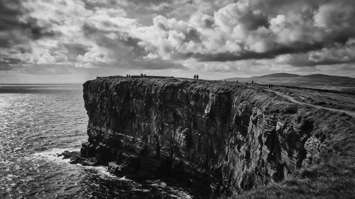
Aillte an Mhothair, on the coast near Liscannor in County Clare, forms a long wall of sandstone and shale cliffs facing the Atlantic along the western edge of the Burren. Rising from lower sections at Hag’s Head to around 214 m (702 ft) near O’Brien’s Tower, this cliff line has become one of Ireland’s defining coastal landscapes and anchors the Burren and Cliffs of Moher UNESCO Global Geopark in the wider limestone plateau above.
Atlantic cliffs along the Burren edge
Aillte an Mhothair stretches for roughly 14 km (9 miles) along the Atlantic coast, from Hag’s Head at the southern end to higher ground beyond O’Brien’s Tower in the north, forming a near-continuous escarpment of rock above the ocean.stretches for roughly 14 km At Hag’s Head the cliffs rise sharply from near sea level to heights over 120 m (390 ft), then gain elevation towards the central and northern sections where the rock stands more than 200 m (656 ft) above the water and reaches a high point of about 214 m (702 ft) close to the tower.
The cliffs form the seaward edge of the Burren, a limestone plateau inland that is recognised as part of the Burren and Cliffs of Moher UNESCO Global Geopark in County Clare.Burren and Cliffs of Moher UNESCO Global Geopark From the cliff tops, the plateau surface lies inland as a karst landscape of exposed limestone pavements, while seaward the cliff faces drop in near-vertical walls to the Atlantic. The location places Aillte an Mhothair on the south?western edge of the Burren region, where coastal cliffs meet the inland limestone terrain.
Sandstone, shale and deep geological time
Geologically, Aillte an Mhothair is composed mainly of alternating beds of Namurian sandstone and shale that were laid down in a marine basin during the Carboniferous period, roughly between 323 and 298 million years ago.beds of Namurian sandstone and shaledeposited in a shallow tropical sea between 323 and 298 million years ago Over time, rivers carried sand, silt and clay into this ancient marine basin; the sediments accumulated in layers which were later compacted and lithified into the rock strata now exposed in the cliff faces.
Individual sandstone and shale layers vary in thickness from a few centimetres to several metres, and together they form up to 200 m of exposed sedimentary rock in the cliff walls.up to 200 m of sedimentary rocks are exposed The lower parts of the cliffs show older rocks, while higher sections expose slightly younger beds, giving a vertical cross?section through part of the Carboniferous sequence. Trace fossils occur widely in these rocks, including worm?like feeding trails and circular burrow casts left by marine invertebrates, making the cliff faces a large?scale record of ancient seabed activity.
O’Brien’s Tower and the cliff?top landscape
Near one of the highest points of Aillte an Mhothair stands O’Brien’s Tower, a round stone tower built in 1835 by Sir Cornelius O’Brien on the cliff top close to the section where the rock reaches about 214 m (702 ft) above the Atlantic.O’Brien’s Tower, a round stone tower built in 1835 The tower occupies a prominent position roughly at the midpoint of the cliffs, marking a reference point where the height is greatest and from which the cliff line runs in both directions.
Around the tower, paths follow the cliff tops with views along the escarpment towards Hag’s Head in the south and towards the northern stretches of Aillte an Mhothair. Inland from the cliff edge, the ground rises into the Burren’s limestone plateau, while out to sea the Atlantic extends towards the Aran Islands and the wider ocean. The combination of sandstone?and?shale cliffs, a nineteenth?century tower and the karst landscape above gives this stretch of coastline a layered character of geology and built structures within a single UNESCO Global Geopark.Burren and Cliffs of Moher have been a UNESCO Geopark since 2011
Visiting Aillte an Mhothair: what travellers from Western Europe should know
- Aillte an Mhothair lies near Liscannor in County Clare on Ireland’s west coast, with road access from the wider region and signed approaches towards the cliffs and the Burren.
- The terrain at the cliffs consists of abrupt cliff edges and uneven ground on the tops, with paths that run close to steep drops above the Atlantic and exposed limestone surfaces inland.
- The cliff line faces the Atlantic Ocean, so conditions can include strong winds and low cloud along the edge; visibility across the ocean and inland plateau depends on the weather on the day.
- Inland from the cliffs, the Burren’s karst plateau rises as limestone pavements with shallow soils and scattered rock outcrops, forming a contrasting walking environment to the sheer coastal edge.
- Ireland’s official languages are Irish and English, and the national currency is the euro (EUR).
Searching for Aillte an Mhothair on social platforms
These links open searches for Aillte an Mhothair on each platform.Frequently asked questions about Aillte an Mhothair
Where is Aillte an Mhothair located?
Aillte an Mhothair is on the Atlantic coast near Liscannor in County Clare, forming the western edge of the Burren region in the west of Ireland.
What should visitors expect at the cliffs?
Visitors encounter a long line of sandstone and shale cliffs rising over 200 m (656 ft) above the Atlantic, with paths along the cliff tops and views inland to the Burren plateau.
What makes Aillte an Mhothair distinctive?
The cliffs combine Carboniferous sandstone and shale faces, a height of around 214 m (702 ft) near O’Brien’s Tower and a position within the Burren and Cliffs of Moher UNESCO Global Geopark.


