
Aillte an Mhothair: Atlantic cliffs at the edge of the Burren
Published on 08/28/2026 at 21:23 | Editorial responsibility: Rafael Müller, Editor-in-Chief AD HOC NEWS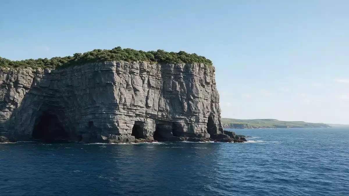
Aillte an Mhothair, on the Atlantic coast near Liscannor in County Clare, is a line of high sea cliffs where dark shale and sandstone meet the ocean in a near-vertical face. Running for several kilometres along Ireland’s western shore, these cliffs form a clear edge to the inland limestone country of the Burren and have become one of the most recognisable coastal landforms on the island.
A coastal wall of rock above the Atlantic
Aillte an Mhothair forms a stretch of cliffed coastline on the western side of County Clare, facing the open Atlantic along a line that extends for about 14 km (9 miles). At Hag’s Head, the southern end of the cliffs, the ground rises to around 120 m (390 ft) above sea level before continuing northwards in a succession of high rock faces and headlands.At Hag’s Head Towards the central part of the cliffs, the land reaches its greatest height, with sections of cliff standing about 214 m (702 ft) above the Atlantic before the line gradually lowers again further north.maximum height of 214 m
The cliffs themselves are formed mainly of Namurian shale and sandstone laid down as sedimentary strata, with the older, darker rocks exposed lower down the faces and younger layers overlying them towards the top.Namurian shale and sandstone Standing along the cliff edge, the bedding planes and banded layers can be seen running horizontally for long distances, while offshore rock formations such as sea stacks show how Atlantic waves have eroded parts of the cliff line over long periods.
O’Brien’s Tower and the Burren and Cliffs of Moher Geopark
Near one of the highest points of Aillte an Mhothair stands O’Brien’s Tower, a round stone tower constructed in 1835 by Sir Cornelius O’Brien as a viewing structure on the cliff top.O’Brien’s Tower built in 1835 The tower occupies a prominent position close to the section of the cliffs that reaches around 214 m above the Atlantic, and from its vicinity the cliff line can be followed visually both towards Hag’s Head in the south and towards the northern stretches beyond.
Aillte an Mhothair lends its Irish name to the wider Burren and Cliffs of Moher UNESCO Global Geopark, which links the sea cliffs with the limestone plateau of the Burren to the north and east.Burren and Cliffs of Moher UNESCO Global Geopark The Geopark recognises the geological continuity between the inland karst landscape and the cliffed Atlantic edge, framing the area as a single region where rock formations, coastal erosion and exposed strata can be observed on a large scale.
Carboniferous origins and the meaning of the name
The rocks that make up Aillte an Mhothair were formed during the Carboniferous period, more than 300 million years ago, when rivers carried sand, silt and clay into an ancient marine basin. Over time, these sediments were compacted into layers of shale and sandstone, later uplifted and exposed as the cliffs visible today.Upper Carboniferous shales and flagstones Geologists describe the cliffs as an important section of the Clare Shale Formation and related units, where individual strata can be traced for considerable distances along the coast.
The Irish name Aillte an Mhothair refers directly to the cliffs of An Mothar, with An Mothar itself meaning “the ruin” in Irish.Aillte an Mhothair ‘the cliffs of An Mothar’ Historical placename records trace An Mothar to forms such as Mothar Uí Ruaín, connecting the modern cliff line with earlier references to a ruin on this stretch of coast and giving Aillte an Mhothair a name rooted in the older Irish language landscape of County Clare.
Visiting Aillte an Mhothair: what travellers from Western Europe should know
- Aillte an Mhothair lies on the Atlantic coast of County Clare, west of Ennis and near Liscannor, and is reached by roads that follow Ireland’s western shoreline.
- The terrain at the cliffs involves high, exposed ground above the sea, with paths following the line of the cliff edge and sections where the rock drops steeply to the water below.
- The Burren region lies inland to the north and east of Aillte an Mhothair, so a visit to the cliffs can be combined with time on the limestone plateau and its karst pavements.
- The official language is Irish and English and the currency is the euro.
Searching for Aillte an Mhothair on social platforms
These links open searches for Aillte an Mhothair on each platform.
Frequently asked questions about Aillte an Mhothair
Where is Aillte an Mhothair?
Aillte an Mhothair is on the Atlantic coast of County Clare in western Ireland, near Liscannor and forming part of the Burren and Cliffs of Moher region.
What should visitors expect at the cliffs?
Visitors encounter a long line of high sea cliffs with exposed shale and sandstone faces, paths along the cliff edge and wide views over the Atlantic and the inland Burren.
What makes Aillte an Mhothair distinctive?
Aillte an Mhothair is distinctive for its combination of Carboniferous sedimentary rock strata, heights reaching about 214 m above the ocean and its role within the Burren and Cliffs of Moher UNESCO Global Geopark.


