
Abel Tasman National Park and its golden coast
Published on 09/19/2026 at 15:12 | Editorial responsibility: Rafael Müller, Editor-in-Chief AD HOC NEWS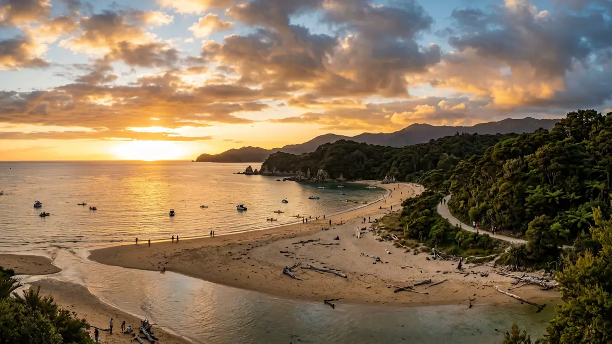
Abel Tasman National Park is a coastal park at the top of New Zealand’s South Island, near Marahau and between Golden Bay and Tasman Bay. It was established in 1942, and the Department of Conservation gives its area as 22,530 hectares.
The park’s identity is coastal rather than alpine. Long beaches, estuaries, bush-clad slopes and offshore islands define the landscape, while the name keeps Abel Tasman, the Dutch navigator, in view.
Coast, bays and bush
The setting is built around the shoreline. Tasman Bay lies to one side, Golden Bay to the other, and the park occupies the land in between, with the coast running past beaches and headlands.
Its landscape combines low coastal hills, native forest and sheltered coves. That mixture gives the park a clear visual shape, even before any track, kayak or boat comes into the picture.
Abel Tasman, 1942 and the park’s name
The park takes its name from Abel Tasman, the Dutch explorer who visited the area in 1642. Its formal establishment in 1942 marked the 300th anniversary of that visit, a date that remains central to the park’s identity.
The name is more than a label. It ties the landscape to a specific moment of European contact, while the surrounding coast keeps the historical link anchored in place rather than in abstraction.
Marahau and the southern approach
Marahau sits at the southern edge of the park and serves as the best-known access point for the coastal track. The surrounding district also includes Kaiteriteri, Motueka and Takaka, which place the park within the wider Nelson Tasman region.
The park’s coastal character remains visible from the first steps inland. Beaches, bush and tidal inlets are never far apart, and the shoreline stays close throughout the southern end of the park.
Visiting Abel Tasman National Park: what travellers from Western Europe should know
- Marahau lies at the southern entrance to the park. Roads lead there from the Nelson area, and Kaiteriteri is another access point on the coast.
- The park is coastal and partly tidal. Estuaries, beaches and inlets shape movement along the shore, while inland routes cross forested country.
- The terrain combines sand, bush and headlands. It is a place of shoreline walking and water access rather than broad paved promenades.
- The official language is English and the currency is the New Zealand dollar.
- Entry requirements depend on your nationality; UK travellers can check the FCDO travel advice at gov.uk/foreign-travel-advice, Irish travellers the Department of Foreign Affairs at ireland.ie.
Searching for Abel Tasman National Park on social platforms
These links open searches for Abel Tasman National Park on each platform.
Frequently asked questions about Abel Tasman National Park
Where is Abel Tasman National Park?
It lies at the northern end of New Zealand’s South Island, near Marahau, between Tasman Bay and Golden Bay.
What should a visit to Abel Tasman National Park be like?
Expect a coastal landscape of beaches, bush, inlets and headlands, with access by road from the Nelson area and by boat along the shore.
What makes Abel Tasman National Park distinctive?
Its combination of a 1942 national park designation, a name linked to Abel Tasman and a strongly coastal setting gives it a clear historical and visual identity.


